01 Feb Mileposts
I am featherlight, tossed like confetti into a brilliant blue sky, jostled about on the velvet wings of thousands of birds — tundra swans, herons, snow geese, northern pintails, marbled godwits. I roll from one downy back to another as we soar in harmony toward the morning sun. Until my sense of euphoria ends abruptly at the trill of an alarm.
I slip out of bed and pull on a pair of fleece-lined jeans and a hooded sweatshirt, anticipating the below- freezing temperatures and piercing winds that await me. My daypack, stuffed the night before, has binoculars, thermal mittens, two Sibley bird books, a wool blanket, four Blackwing #602 graphite pencils, and my composition notebook. I add a sandwich and thermos of hot coffee, pull on a pair of thick wool socks, muck boots, and a down parka, and head to the car.
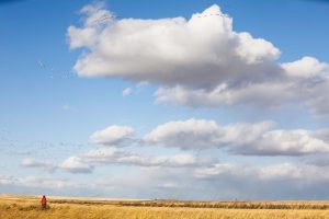
The WMA sits on the western edge of the Greenfield Bench in north central Montana. The area attracts more than a million birds each year and offers year-round access to wildlife viewing. In the summer and early fall, snow geese spend an average of four days resting and feeding on the freshwater lakes, ponds, and surrounding harvested grain fields before flying on to their nesting grounds in the Canadian arctic. Photo by MELANIE MAGANIAS
The moon, a few days shy of full, is chalk-white against a soot-black sky, its reflection casting a luminous sheen on the outlying frozen fields. The March thaw is evident in the soft crunch of ice beneath my boots. I drive from the front gate down Nine Mile Prairie Road, over 4 miles of muddy ruts and potholes, before turning left onto the smooth, quiet tarmac of Highway 200 at milepost 26. Thank you, Montana, for having the wisdom to place green rectangular mile markers along most of our numbered roads, making it easy to identify my location.
The Big Blackfoot River, paralleling the highway, will be my companion for the next 67 miles as we wind through the valley together. The Nez Perce called this section of the Blackfoot River the Qoq’aalx ‘Iskit (“River of the Road to the Buffalo”); it’s one of the routes the Indigenous people traveled for more than 10,000 years on the way to their sacred buffalo hunting grounds east of the Continental Divide.
Highway 200 wanders 1,356 miles from Idaho to Minnesota. Much of the route through western Montana is remote, surrounded by wilderness and mountain ranges — the Bob Marshall, Swans, Garnets, Great Bear, and Scapegoat. The reflection of the car’s headlights dances in the dark ahead, flickering over bare willows and cottonwoods along the sides of the highway. I check the time on the car’s dashboard — exactly 4 a.m. My destination is Freezout Lake, 138 miles east. Barring no complications, like hitting a deer or elk, I should arrive at the lake before sunrise. My excitement grows with each mile.
The Freezout Lake Wildlife Management Area lies at the base of the eastern front of the Rocky Mountains and Continental Divide in north central Montana. During the March migration, an estimated 100,000 snow geese and 10,000 tundra swans stop at Freezout Lake and the surrounding ponds to rest and forage on the outlying fields of spent grain before traveling north to their seasonal breeding grounds in Canada and the Arctic. The annual event draws thousands of visitors to the area. For birders, both professionals and novices like me, Freezout Lake is nirvana, an annual opportunity to witness nature up close, in all its glory.
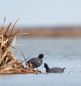
Two American coots bask in the winter sun at the edge of Pond 4. The American coot is one of an estimated 200 species of migratory birds arriving in late March to find rest and forage in the WMA. Not a duck, the coot has lobed toes rather than webbed feet, which allow them to navigate below the surface of the water for food. Coots can be loud and aggressive and are known to eat other birds’ eggs. Photo by KYLE MOON
Purchased by Montana Fish, Wildlife & Parks (MT FWP) in 1953, the wetland area includes 11,350 acres of shallow freshwater lakes and ponds interconnected by an irrigation system that controls water level and flow. Freezout Lake, Priest Butte Lake, and ponds numbered 1 through 6 are surrounded by rich, luxuriant short-grass prairie. MT FWP manages the area with two goals: to provide a staging habitat for seasonal migratory birds and to offer year-round viewing to visitors interested in seeing game birds, raptors, waterfowl, and shore birds. More than 200 different bird species have been documented at the site.
In the last 10 years, I’ve made this same drive three times, only to miss the peak of the migration. This time, I have diligently checked the MT FWP website for daily reports on the bird’s migration status.
At milepost 71, I approach the sleepy town of Lincoln, population 1,100. Lincoln is best known for its infamous former resident, Ted Kaczynski, aka the Unabomber. Kaczynski lived off the grid, on the southeast side of town, in an area some locals called the “Potato Patch,” a haven for recluses seeking isolation.
As I leave the outskirts of town, I exhale slowly, relieved to see Lincoln in my rearview mirror. But immediately, I have second thoughts. Lincoln has a diverse history of mining, ranching, and logging. In 2013, to celebrate its unique past, the community created the award-winning Blackfoot Pathways: Sculpture in the Wild, an international park designed to connect us through nature and art with the environmental and cultural heritage of the Blackfoot Valley. I remind myself that Lincoln, like life, is a dichotomy. Nothing is truly black or white.
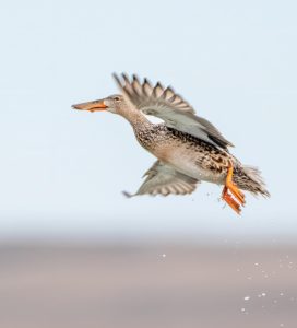
A lone female Northern shoveler drifts on final approach to Pond 1. Northern shovelers migrate to Northern Canada and Alaska in small groups of 15 to 20 birds, traveling mostly at night. The female has mottled brown-to-buff feathers and a long, shovel-shaped “spatulate” orange bill used to filter out food particles she draws from the water. Her breeding male counterpart sports a dark green head, white breast, and chestnut sides. Photo by KYLE MOON
Just before milepost 82, I pass the turnoff to the Alice Creek trailhead, famous for the spot where Meriwether Lewis crossed over the Continental Divide in 1806. In the summer, the trail climbs through wildflower meadows intense with color — emerald green gentian, sapphire blue forget-me-not, purple plum phacelia — before finally reaching the saddle of the pass between Red Mountain and Green Mountain.
At milepost 87, Highway 200 continues its gradual climb toward Rogers Pass, 5,610 feet above sea level. Dense forests of ponderosa pines, Douglas firs, aspens, and cottonwoods skirt both sides of the highway. In the prelude to dawn, I see wisps of indigo against the black horizon ahead. On the right is the turnoff to the Mike Horse Dam Superfund site, situated at the headwaters of the Blackfoot River. The restoration project began in 2014 to remove contaminated soils left from old gold mines that operated from 1889 through the 1950s. In the process, 1 million cubic yards of tailings and waste have been removed from the riverbed.
I sigh, knowing the headwaters of the Blackfoot River have been successfully restored, providing a healthy environment for native westslope cutthroat and bull trout born wild in their natural habitat. Born wild demands repeating. I think about the red bumper sticker on the back of my car: Keep it Wild. I received the sticker 10 years ago after donating to the Montana Wilderness Association. I lower the driver’s window and shout into the rushing cold air, “Keep it wild, Montana! Keep it wild!”
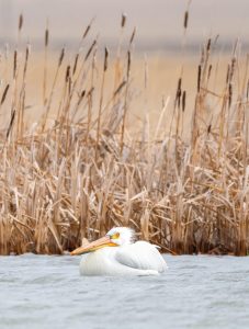
An American white pelican rests beside a thick stand of cattails on the edge of Pond 2. Boasting a 9-foot wingspan and up to 4 feet in length, the white pelican is one of the largest birds in North America. Despite their hefty size, pelicans are good swimmers and agile in flight. Photo by KYLE MOON
Just short of milepost 90, I pass a spot famous for having the coldest recorded temperature in the contiguous U.S., a record that still stands today. On January 20, 1954, at the mouth of the old 4 K’s Mine, with more than 5 feet of snow on the ground, the temperature was officially recorded at minus 69.7 degrees Fahrenheit. The thought of it gives me shivers, and I reach for my thermos of coffee sitting in the cup holder on the console beside me.
At milepost 90, as I leave the Blackfoot Valley and crest the summit at Rogers Pass on the Continental Divide, the state’s eastern side unfolds. Still dark, I can see a slight hint of pink dawn against the otherwise obscure backdrop. Spirits high, I begin my descent into the wide-open grasslands of the Northern plains. I have 74 miles to go to reach Freezout Lake.
My mother loved to sit outside in the early morning in Texas, listening to the chatter of purple martins that arrived each spring to nest in the white three-story birdhouse my father built for her in the back meadow. She would look up and whistle, imitating their song, before softly calling out, “Pretty birds, pretty birds.” If my mother was alive today, she would be thrilled to experience the birds at Freezout Lake. I pretend she is sitting beside me.
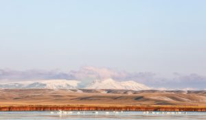
Looking west from Freezout Lake, rolling grasslands stretch 28 miles to jagged snow-covered peaks rising abruptly along the Rocky Mountain Front. Photo by MELANIE MAGANIAS
At milepost 138, I leave Highway 200 and turn left onto Highway 89, heading northeast toward Fairfield in the final stage of my journey. It’s 5:57 a.m. The moon is quickly disappearing behind the front range of the Bob Marshall Wilderness to the west. In the east, the sky is metal gray, heavy with enormous rose-tinged black clouds the size of ocean liners floating above the horizon.
The landscape on the east side of the Continental Divide is starkly different from the west, which is known for coniferous forests, mountain ranges, and high alpine lakes. The east side is a vast, undulating prairie, once the immense floor of an ancient sea eroded into buttes and mounds through millions of years of gale-force winds, pelting rain, and extreme temperatures. Montana is the fourth largest state in the U.S. — striking for its geographic size but scant in population, with slightly more than a million people. Sky and land merge into one seamless landscape — hence the nickname “Big Sky Country.”
On the outskirts of Fairfield, past the long row of grain silos, Ponds 5 and 6 appear on my left, followed by Pond 3, all outliers of the much larger Freezout Lake beside them. In the distance, I see the dark silhouette of Priest Butte. I park at a spot on the right, between Pond 1 and Pond 4, which is known for having some of the best views of the wildfowl. As planned, I arrive as the sun rises, yellow gold against the blush pink stretching across the plains.
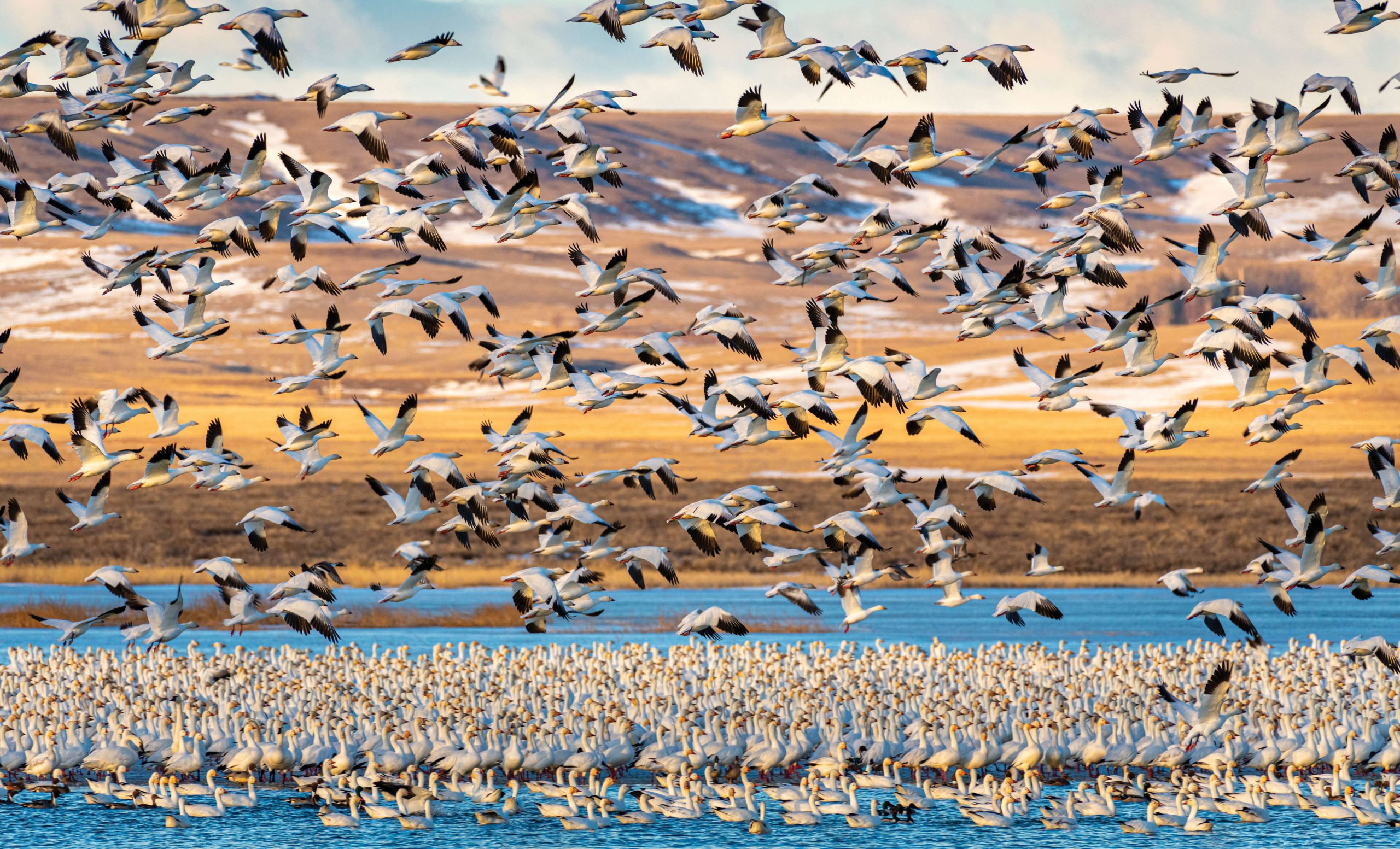
I hear the birds before I can see them, tens of thousands on the water. Birds everywhere — honking, squawking, quacking, flapping. The volume of their cacophony is as deafening as a passing freight train.
Standing outside the car, I breathe in the rich, organic scent of prairie grass, wheat, malt barley, and loam. The morning smells fresh and clean. Bystanders, many holding binoculars or peering through high-powered spotting scopes, are scattered along the gravel roads at the edge of the ponds. Others have cameras or cell phones held high to capture the surreal mass of feathers floating on the ponds. Some spectators huddle close, wrapped in colorful coats, scarves, and mittens like Christmas presents. The wind is relentless.
As the sun peeks above the horizon, the air hums like an electric charge and buzzes with the frenetic flutter of thousands of wings. All eyes are on the water. I swing my binoculars right to left, scanning the ponds, wondering which bird, snow goose, or tundra swan will be the first to take flight.
Seconds later, crystal clear water streaming through their feathers, they lift in unison in a perfectly choreographed ascent. Tens of thousands of bodies — feathers, beaks, pneumatic bones, large hearts, and wings — rise gracefully, effortlessly, against a carnation pink sunrise. They are obviously communicating through a sophisticated group intelligence.
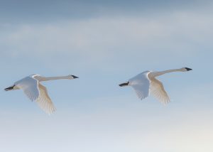
Two trumpeter swans glide gracefully above the eastern shore of the lake. While still considered an at-risk species, intense conservation efforts have brought the swans back from near extinction in the 1930s to numbers upward of 60,000 today. Trumpeters are the largest and heaviest native waterfowl in North America, easily identified by their snowy white feathers, distinctive bugle call, and solid black bills and markings that extend into their eyes. Photo by KEVIN LEAGUE
I look up in wonder. I feel connected. My spirit lifts with them. I imagine lines from K.D. Lang’s haunting rendition of “Hallelujah”:
I heard there was a secret chord
That David played, and it pleased the Lord
. . . Well it goes like this,
The fourth, the fifth
The minor fall, the major lift
. . . Hallelujah, Hallelujah
As their formation begins to spread out and slowly disappear, myriad emotions surface. I want to fly with them. How can I capture this moment forever? I miss my mother. Why are we destroying the natural world?
Later, as I drive home, retracing my earlier route along Highway 200, I think about the significance of mileposts along my journey through life. A sense of place resonates, sustains me. I visualize the landscape in layers that beg to be peeled back, explored. I am moved by my experience at Freezout Lake, my connection to nature, local history, memories of my mother, the journey itself.
Back at milepost 26, I turn off Highway 200 onto Nine Mile Prairie Road, home again with my beloved rough-legged hawks, ravens, and bald eagles who winter in the valley with me. Like my dream this morning, I want to believe we can all soar together, in harmony, toward the morning sun.
Deborah Houlihan O’Connell is a freelance writer whose essays and poetry are inspired by our inherent connection to nature and the wildlife and landscape that surrounds us. She lives with her husband, Jerry, and dog, Burnfoot, on the banks of the Blackfoot River in western Montana. When she isn’t writing, she is out walking in the wilderness.


Bernie Dazwood
Posted at 21:58h, 02 FebruaryBeautiful story of birds, of family, and life in Montana. I am misty-eyed.
Rick Bridwell
Posted at 18:40h, 05 FebruaryDeb I felt like I was in the trip with you. An amazing articulation of the scenery through your lens. Thanks for writing the piece and bring a piece of the experience to me.
Larry and Susie Carrington
Posted at 01:16h, 11 FebruarySusie and I felt like we were riding along shotgun and we could see and feel the amazing expression of nature at its explosion of beauty. Thanks for taking us along.
Tim Ryan
Posted at 01:47h, 16 MarchPretty magical writing conveying the author’s vision. She exhibits an ability to create a sense of being in the place she’s describing.