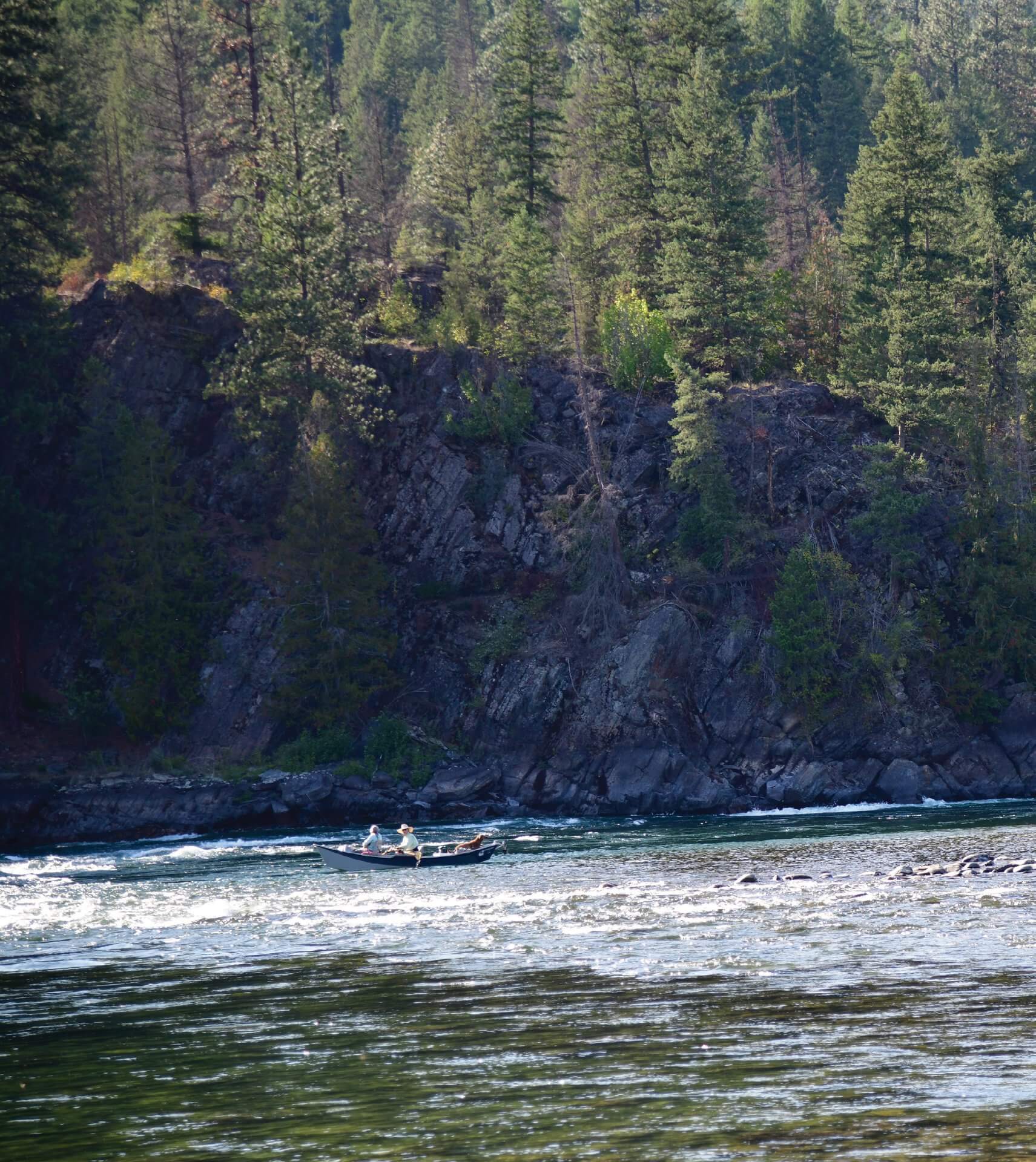
28 Sep Montana’s Wild Yaak River Country
Remember, raise your hoods at night so packrats don’t build nests in your engines!” The campground host’s admonition seemed slightly odd, but she walked on, continuing her evening rounds. My partner Mary and I looked at each other, baffled. My bemused, stubborn, initial reaction: “No way am I going to comply with this nonsense!”
Then, I cracked a campfire beer, relaxed, and scanned the tree-shrouded campground. Neighboring vehicles already had their hoods up, ready to check-mate the prodigious bushy-tailed rodents inhabiting extreme northwest Montana’s Kootenai National Forest. The theory, after serious consideration over ale, is if the rats realize they lack a “roof,” they won’t bother constructing a new home.
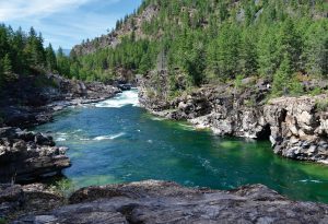
This deep pool below Kootenai Falls is featured in the popular 1994 Meryl Streep film The River Wild.
Anyone who has experienced packrat issues knows what a menace these industrious creatures are to a functioning vehicle. It previously happened to Mary and me when we let our truck sit — hood down — while on a multi-day float trip. The biggest danger from the toothy rats — aside from leaving a mess of combustible debris, dung, and pilfered shiny treasures — is that they can chew through critical wires or hoses. Having already learned the hard way, and after reconsidering the campground host’s words, we got with the program, patriotically hoisting our hood like the American flag.
Exploring and Fishing a Remote Landscape
As usual, fly fishing was a pretext for our road trip from Helena into this geographic lacuna, an investigation of terra incognita, a window into another new world: Tucked in Montana’s upper northwest corner, near Idaho and British Columbia, this secluded region is largely off the busy Glacier and Yellowstone tourist circuits, even for vagabonding Montanans. Visitors make a conscious effort to get here, rather than just washing up. It’s biologically unusual too, as the damp, densely forested landscape is more like the Pacific Northwest than Montana’s otherwise vast aridity. Emblematic of this climate are the ancient, protected Ross Creek giant cedars, Big Sky’s version of California’s redwoods and sequoias.
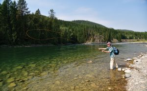
The author lays out a cast on a perfect run on the Kootenai River. The river remains icy, inviting, and fishable even on hot summer days.
The isolated territory is delineated by rivers and mountain ranges, punctuated with alpine and jungle-like roadless areas. The topography is riven by sprawling Lake Koocanusa and the Kootenai River — Montana’s second largest by volume— and further bisected by the Yaak River and glacially scoured Purcell Mountains. South of the Kootenai, the Cabinet Mountains soar spectacularly, and snowfields feed the Bull River, which drains into Cabinet Gorge Reservoir and the Clark Fork River. Mountains notwithstanding, another oddity is that Montana’s lowest elevation — at 1,820 feet — is located where the Kootenai River meets Idaho.
The Yaak, Bull, and Kootenai rivers — along with spectacular lakes — are escapes for Houdini-like fly anglers, floaters, and others looking to evade crowds on better-known Montana waters. These rivers display a crystalline mix of rapids, riffles, runs, and pools that entrance the most seasoned of anglers. The Yaak, especially, has been recovering from yesteryears, when heavy clearcutting on steep slopes led to freight trains worth of sediment in the stream.
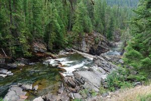
The spectacular Yaak Falls tumbles over bedrock — an extreme navigation hazard for floaters, but a wonderful stop for travelers driving up the Yaak — beckoning fly anglers willing to scramble down to the deep, turquoise pools.
Native salmonids include mountain whitefish as well as bull, westslope cutthroat, and Columbia River redband trout. The latter — a colorful rainbow trout subspecies — originally inhabited the watershed below Kootenai Falls, but today has often hybridized with introduced rainbow strains. Other exotic trout like browns and brookies are also well established. The Kootenai tailwater below Libby Dam is renowned for producing enormous rainbows, having feasted on turbine-stunned fish: The state record was caught here in 1997, a leviathan weighing over 33 pounds.
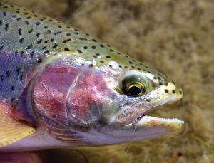
Rainbow trout are common in the Yaak and Kootenai rivers; the latter sometimes surrenders trophy, record-sized specimens.
A Unique Natural History
There are places to get haphazardly, pleasantly lost here. But there are also popular, iconic sites that shouldn’t be missed, including Kootenai Falls, between Troy and Libby. The falls are sacred to the Kootenai Tribe. They were portaged in 1808 by the intrepid explorer, geographer, and fur trader David Thompson, while navigating the precipitous gorge using Indigenous cairns. Into the 1970s, proposals to build dams here failed due to opposition by conservationists, including the Kootenai people.
Here, the enormous Kootenai River thunders over cataracts, with vistas and recreational access provided by Kootenai Falls County Park and the U.S. Forest Service. Hillside trails wind above the falls; a concession stand awaits hungry hikers upon return. This raucous reach was featured in The River Wild, a popular 1994 film starring Meryl Streep and Kevin Bacon about violent rafting misadventures. During shooting, an exhausted Streep — gamely performing whitewater stunts — nearly drowned after being swept into frigid rapids, but was eventually rescued by Bacon. She later told the director, who had begged for another take after many hours of filming: “In the future, when I say I can’t do something, I think you should believe me.”
According to geologists David Alt and Donald Hyndman (Roadside Geology of Montana): “The Kootenai River … drops about 200 feet over the two cascades in an almost unspoiled setting. By any standard of comparison, these are … one of the largest in the country. Many people also think them among the most beautiful.”
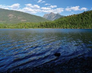
South of the Yaak River watershed, Bull Lake and River provide more angling opportunities, and additional excuses to explore the vast Kootenai National Forest. A conifer-shaded campground on the lake affords views of peaks soaring from the Cabinet Mountains Wilderness.
When Mary and I visited, there was a van in the parking lot (looking straight out of Haight Ashbury, circa 1967’s Summer of Love) decorated with colorful artwork and maxims: “This is the strangest life I have ever known,” “Love is a boomerang, give it a toss,” “May the forest be with you,” and “Staying away from white bread is a lot like staying away from crazy women. When I see white bread, I still want it.” It turned out the owner was a wood carver, working on his art at a nearby picnic table, chatting with visitors and making sales.
Smaller — though no less beautiful — waterfalls decorate the lower Yaak River, and may be readily viewed from roadside pull-offs. Here, the river plummets spectacularly over a bed of Belt quartzite and green Precambrian mudstone, ancient sea remnants. Anglers scrambling down the hillside will find deep, olive-tinted, boulder-filled pools. Beginning in spring, profuse wildflowers illuminate nearby open areas, foragers fill buckets with summer huckleberries, and autumn western larch blaze yellowish-orange.
The environmentally diverse Yaak has been passionately portrayed by acclaimed author and activist Rick Bass. According to the Yaak Valley Forest Council, a conservation group Bass helped found:
The Yaak Valley is a biologically rich landscape harboring an astonishing variety of wildlife and pockets of old-growth forests. Continental weather patterns collide … as colder and drier Rocky Mountain ecosystems meet a steady onslaught of storms and moisture from the Pacific Ocean. The resulting high precipitation, number of cloudy days, and deep winter snowpack create a … climate that supports small pockets of rare inland-temperate rainforest dominated by western red cedar and western hemlock.
The Yaak is a critical reservoir and corridor for wildlife in the Northern Rockies, including wolves and grizzly bears. There are approximately two dozen grizzlies remaining, but the ghost-like population of rare woodland caribou has largely vanished; two were observed in 2018, perhaps British Columbia immigrants. More commonly, travelers spot elk, moose, bighorn sheep, and even pileated woodpeckers. Given this bounty, a sign in the local Yaak Tavern proudly proclaims the valley “the best untouched place in the world.”
Secluded Towns, Remote Highways, and Twisting Backroads
Of course, this Shangri-La isn’t completely untrammeled, but major highways are scarce, which is part of the allure. U.S. Highway 2 is the exception; it follows the Kootenai River from the Idaho border, through Troy and Libby, and on to Kalispell. An excellent rabbit hole that drops into this wonderland is state Highway 508, which heads north along the Yaak River, past Yaak Falls, to the stream’s namesake hamlet. You can then meander south through the verdant Purcell Mountains toward Libby, a slow drive passing the low-key, one-chair Turner Mountain ski area. Wayfarers with more time can proceed north and east on Forest Service Road 92 toward the Yaak headwaters, then drive south on the Lake Koocanusa Scenic Byway toward the Libby Dam.
South of Troy, state Highway 56 leads to Bull Lake, the Bull River, Ross Creek’s giant cedars, and Cabinet Gorge Reservoir. For adventurous wanderers, there are mazes of primitive Forest Service roads, some requiring macho vehicles. There are many national forest camping options, including several of my favorites: Bull River, affording access to both the stream and Cabinet Gorge Reservoir; Bad Medicine, overlooking Bull Lake, close to the giant cedars; Whitetail, a quiet sanctuary further upstream on the Yaak; and the beguiling Yaak River Campground, where the Yaak and Kootenai merge. As a break from fishing, one can happily repose on the shore, reading, sipping Syrah, and watching an occasional drift boat navigate the rapids.
The valley once held massive Glacial Lake Kootenai, impounded by a northern Idaho ice dam; prominent terraces etched around 2,600 feet still mark wave action. The towns of Troy and Libby were founded on logging and mining, including gold, silver, copper, and lead. Growth in both settlements was abetted by construction of the transcontinental Great Northern Railroad through the Kootenai Valley in the early 1890s. As Don Spritzer detailed in Roadside History of Montana, Troy developed such a lawless reputation that train doors were locked to foil robberies. Spritzer reports, “One settler recalled ‘fifteen saloons gaily lit were filled to the doors with wild men and wild women yelling, singing, dancing, and cursing with glasses lifted high.’” Partying notwithstanding, benefits from these efforts continue today: Travelers can board an Amtrak Empire Builder passenger train in little Libby and head to Seattle, Portland, Minneapolis, or Chicago.
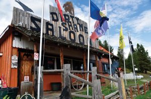
After camping in the remote Kootenai National Forest, the tiny town of Yaak offers a pleasant break: a cold beer, cheeseburger, and chance to catch up on local news.
Libby’s economy was boosted when what eventually became the country’s largest vermiculite mine opened in 1925. Libby vermiculite was widely employed for fire-proof insulation, acoustical plaster, and soil enhancement, but its fine, asbestos-laced dust precipitated a tragic epidemic of deadly asbestos-related diseases among the defenseless residents. The mine closed in 1990, with millions of dollars subsequently spent on environmental remediation. Today, both Libby and Troy are interesting riverside towns to visit, places to re-supply before further roaming this rugged country. As a reminder of who established the surrounding Kootenai National Forest in 1907, former president Teddy Roosevelt’s initials persist on Troy’s community hall.
Deeper in the hinterland is Yaak — population somewhere north of 300 souls — one of Montana’s most remote towns. Sojourners can replenish basics at the Yaak River Tavern & Mercantile and enjoy a post-fishing beer and burger on a pleasant deck overlooking the river. Tellingly, given the thick forest surrounding town, images of Bigfoot are scattered around the bar: If the ape-like Sasquatch exists anywhere, it’s probably here.
Across the street, the Dirty Shame Saloon has long anchored the north side of town. Over the years, it’s developed notoriety for wet t-shirt contests, rowdy drinkers, speakers blasting Lynyrd Skynyrd, and an employee who once shot out a refrigerator. A friendly word to the wise: This probably isn’t the place to stand on your barstool and boldly declare visions of a revolutionary socialist America. Neil Young, Grateful Dead, or “Celebrate Diversity” stickers on your bumper might be ok, but no guarantees. Be humble, respectful guests — ask honest, not loaded questions — and appreciate what residents offer, even if you don’t agree with everything.
As Mary and I nursed beers, we visited with an amiable local who explained Yaak country culture: “You have to want to live here; people don’t like to leave once they set down roots. But it’s tough making a living, so folks will resort to everything — even collecting aluminum cans — just to hang on and stay.” And people like their privacy: “I live a half-mile from my nearest neighbor — who I like — and that’s still too close.” As Bass wrote in The Book of Yaak, “I see more and more the human stories in the West becoming those not of passing through and drifting on, but of settling in and making a stand.”
While finishing lunch, I thought of a colleague’s observation after a lively, far-flung public meeting when we worked for Montana Fish, Wildlife & Parks: “There’s a reason people live at the end of the road.” Mary and I returned to our glen-like, Yaak-side campsite. We rigged fly rods for the evening hatch, then dutifully raised our hood before setting off. It worked like a charm the entire trip; we remained free of packrat infestations and soon felt like knowledgeable locals, ready to earnestly explain the rationale to other visitors.
Northwest Montana: The Cabinet Mountains and Ross Creek Cedars
South of Libby and Troy lie the sky-piercing, mountain goat-inhabited, lake-splattered Cabinet Mountains, which were among the original areas protected by the landmark 1964 National Wilderness Preservation Act. To access the remote glacial cirques and trout tarns of this 94,272-acre pristine area, anglers have to lace hiking boots or saddle up horses and take advantage of 143 miles of designated trails. Hikers might spot and hear chirping, talus-dwelling picas, and, less commonly, grizzlies, wolverines, and Canada lynx.
Snowshoe Peak — the highest between Glacier National Park and Washington’s Cascade Range — rises to 8,736 feet, offering expansive vistas for climbers. The Cabinet Range high country captures up to 100 inches of precipitation annually, with some slopes receiving Montana’s greatest snowfall. This bounty feeds more than 50 lakes and many streams, some sheltering native bull and westslope cutthroat trout. The Cabinets have long been immersed in a legal push-and-pull controversy over proposed copper and silver mines that would be adjacent to, and tunnel under, the wilderness area, potentially threatening federally protected grizzly bears and bull trout.
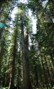
Fed by abundant precipitation more akin to the Pacific Northwest than much of semi-arid Montana, the ancient, protected Ross Creek giant cedars are Montana’s version of the redwoods.
On the western edge of the wilderness, Bull Lake affords excellent, readily accessible panoramas of the wilderness. For campers, the protected Ross Creek Cedars Scenic Area is only a short drive. An easy interpretive loop trail winds through these magnificent, 500-year-old patriarchs, in a moss-, lichen-, and fern-filled rainforest environment. Some of these giants are 175 feet tall, with an 8-foot diameter, having survived the apocalyptic 1910 Big Burn forest fires. Ross Creek is unusual itself, partially disappearing underground during dry weather, leaving scattered runs and pools for amphibians and other aquatic life. When Mary and I visited, creative folks had constructed mysterious cairns in a dry creek bed. Like the cedars, they seemed like totems from a lost era.


No Comments