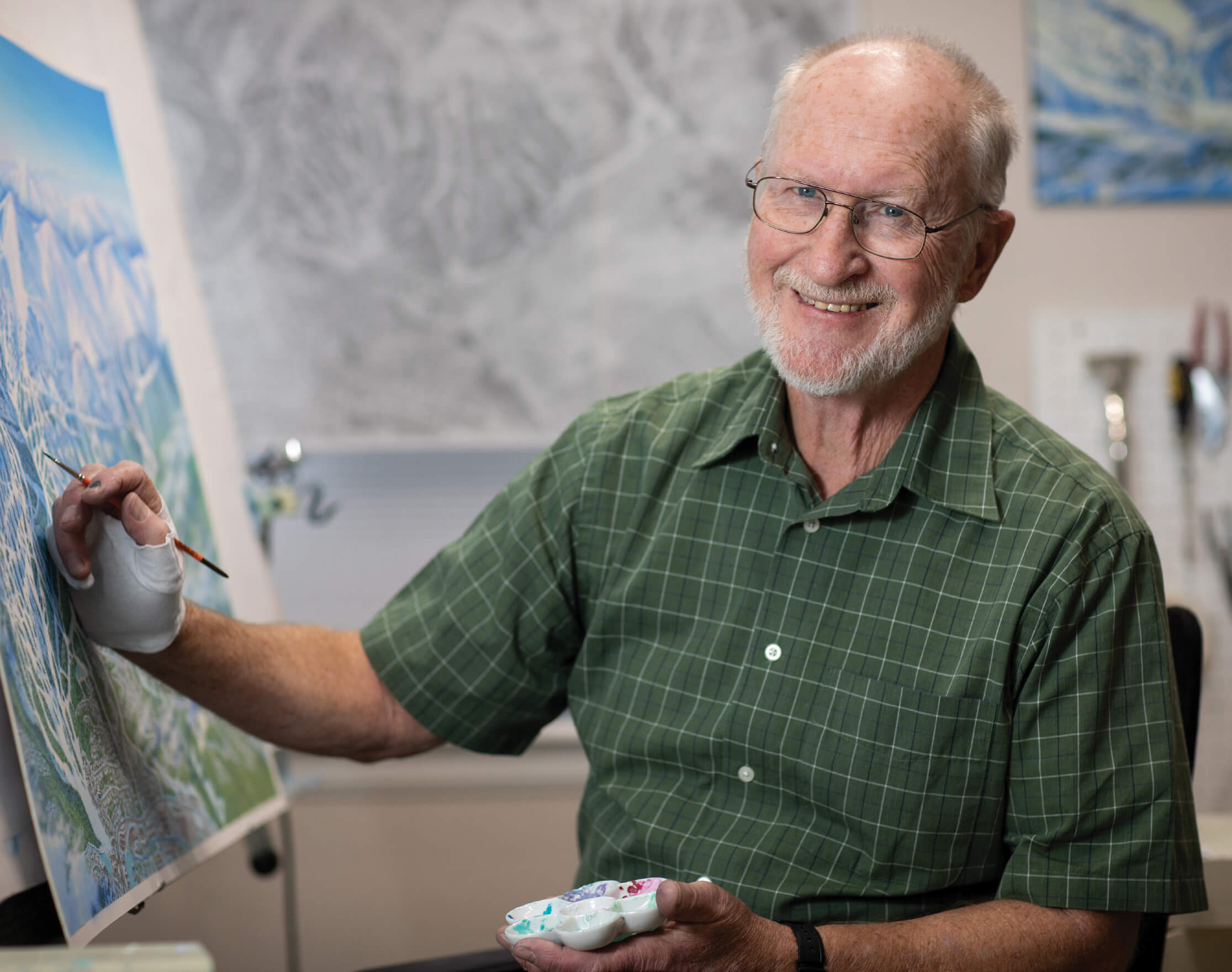
24 Nov Artist of the West: James Niehues
Maps hold a promise of roads untaken, the allure of the exotic, and adventures yet to come. For James Niehues, a legend in the ski world for his bird’s-eye maps, his works are much more than renditions of place. They combine panoramic views of the best ski hills in the world with a firsthand experiential component: It’s a continuous view, from both close up and far away.
Over his 35-year career, Niehues has created trail maps for more than 200 ski resorts spread across five continents, and it’s clear he loved the work. “The trail map promotes the area and shows what one would experience there,” he says. “That’s where the beauty comes in — it’s not just lines pointing the way, it’s more than that.”
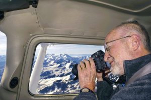
Niehues flies above a mountain while taking photographs to obtain the bird’s-eye views he needs to create his intricate ski trail maps. COURTESY OF JAMES NIEHUES
Much like the open-ended twists and turns of a downhill ski trail, Niehues’ journey as a young illustrator, mapmaker, and landscape artist has unfolded in unexpected ways, requiring his proficiency in specific techniques. Early in his career, Niehues moved to Denver with his young family, where he did odds and ends, trying his hand at freelance illustration. “The idea came to me to look up [ski trail map artist] Bill Brown,” Niehues says. “I liked what he did and wondered if I could help him out a bit. I’d taken on a project from him, the backside of Winter Park’s Mary Jane Resort. He liked what he saw, and we presented it to the ski area. And that was my first illustration of a ski map.”
It’s hard to believe, but Niehues had little art training when he started working with Brown. “I took a correspondence course called Famous Artist School during my high school years and [spent] a year at Mesa Junior College [now Colorado Mesa State] in Grand Junction, Colorado,” he says. “At that time, I was in line to be drafted, so I enlisted into the Army.”
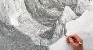
Here, he finishes a pencil drawing of Bridal Veil for his American Landscape Project. COURTESY OF JAMES NIEHUES
After his time in the Army, Niehues took a job producing various promotional materials and literature for an after- market automotive instrument manufacturer. Through this position, Niehues improved his drafting skills and learned how to draw. But it wasn’t until he began working with Brown and producing ski-trail maps that Niehues became an avid skier. “I felt it was important that I got on the slopes and experienced it,” he says.
Aside from spending time on the ski hills, he also needed to learn aerial photography. “That helped me to get the reference points,” he says. “I would fly the area and photograph it personally because it was hard to direct someone to photograph it for me. I needed it to be a downward angle, but they would shoot across, and trees would cover up the trails, the width of the run, and the steepness of the run.”
Over the years, Niehues’ maps came to decorate many young skiers’ walls. His work follows two generations of niche artists, Hal Shelton and Bill Brown, who knew and understood skiers and skiing — artists with the talent to condense an expanse of towering mountains onto a comprehensible two-dimensional piece of paper. “I just loved the work and the challenge,” he says. “It’s a very creative approach that many people don’t see.”
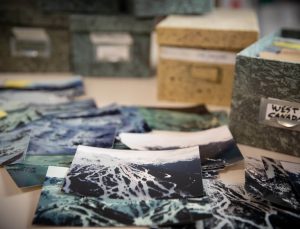
Niehues’ photos provide quick reference, verifying the smallest of details, throughout his creative process. LINDSAY PIERCE MARTIN
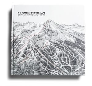
In celebration of his prolific career, Niehues worked with avid skiers Todd Bennett and Ben Farrow to create and publish The Man Behind the Maps: Legendary Ski Artist James Niehues in 2019. The classic coffee table book features 200 of Niehues’ beloved maps. It’s a project Niehues first imagined in the 1990s, so when he was approached by Bennett and Farrow in 2017, he was ready.
“We launched on Kickstarter in 2018 and wanted to raise $8,000 for a passion project,” Bennett says. “The day we turned it on, we raised $50,000 with 5,500 supporters.”
“It was the best decision I have ever made,” Niehues says. “Todd Bennett and Ben Farrow have produced a book that has sold over 150,000 copies and is still selling well.”
Yet, in 2021, after 35 years of mapmaking, Niehues decided to retire from one craft to pick up another: a series of drawings he’d wanted to sketch for years. His American Landscape Project combines the wonder of mapmaking and the fine-art skills he learned long ago. His intricate pencil drawings of iconic landscapes across the country convey a deep understanding of place. “The time constraints of painting led me to drawing,” he says. “My original goal was 50 [drawings], and I’m up to 61, so my new goal is 100. I’m having a lot of fun doing it.”
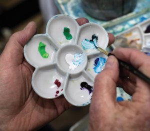
Niehues’ small palette of gouache paints, nearly dwarfed by his hand, is all he needs to provide the shadowed depths and shining peaks present throughout his renowned maps. LINDSAY PIERCE MARTIN
Niehues visits beautiful places across the U.S. and sketches not only what he sees but what he feels. “Photographs have their place, but I don’t think they do justice to a scene,” he says. “Part of what we ‘see’ in a landscape [is] the emotion it makes us feel. Our memory of a place is a combination of what our eyes saw and also what it felt like to stand there and take in the view. To me, it’s what our feelings add that are the core of any memory of a place.”
The American Landscape Project is comprised of black-and-white drawings, and, in many ways, they echo the ethos of Ansel Adams’ dramatic vistas. Working with tones, values, and texture instead of colors, Niehues offers the timelessness one feels when in the presence of nature’s grandeur. There’s an intriguing marriage of precision and imagination, a mind-wandering, map-inspired, restless longing that lies beneath the surface of each piece.
His drawings place the viewer onto the landscape. And, with his intimate knowledge of mountainous terrain, Niehues understands how to do that with seemingly effortless grace. “I’m an explorer and dreamer myself,” he says. “I want people looking at each of these to be transported to a place they know and love, [to] be inspired to go and visit a new place, or to connect with a place they’ve dreamed about.”
Picking from the bounty that is the North American landscape is among Niehues’ greatest challenges. “With [the maps], I knew I’d be painting the resort that hired me. With the American Landscape Project, literally every gorgeous vista in the country is an option. Originally, I thought ‘iconic’ scenes meant national parks, which is still broad but at least finite. However, this country has so much amazing scenery that isn’t in a national park.”
While Niehues explores the breadth of his new work, he does so peacefully, knowing his mapmaking legacy will persist. Rad Smith, whom Niehues mentored, has taken up the baton and is creating his version of ski-trail maps while remaining inspired by his mentor. “I love his work,” Smith says. “It just keeps getting better and better. He’s so enamored with American landscapes, trying to capture all these beautiful views. Part of the process with trail maps is the step when you use [a] pencil to sketch out the map before the painting comes in. He’s taken that step [and] expanded on it, producing very rich pencil drawings that stand on their own. There’s a lot of texture in his drawings, and that pencil medium allows him to break it down into texture and tone. He has a wonderful way of combining elements and capturing the feel of a place.”
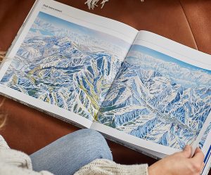
Prolific in his own right, Niehues has hand-painted over 430 maps on five continents throughout his 30-year career. The Man Behind the Maps: Legendary Ski Artist James Niehues features more than 200 hand-painted ski resort trail maps as well as background regarding Niehues, his process, and the wild spaces he’s captured. OPEN ROAD SKI COMPANY
Emotion has always been integral to Niehues’ works. Not only the feelings a person experiences in the presence of beautiful places but also the intricacies of mountainous terrain and how that is interpreted by a skier. Although Niehues couldn’t have predicted his journey, he worked his way into the position of one of the foremost ski hill mapmakers in the country. As one thing led to another, Niehues followed his own trail and continues to do so with his fine-art sketches.
Freelance art writer and author Michele Corriel earned her master’s degree in art history and her doctorate in American art. She has received a number of awards for her nonfiction, as well as her poetry. Her latest book is Montana Modernists: Shifting Perceptions of Western Art (Washington State University Press, 2022).


No Comments